 |
|
|
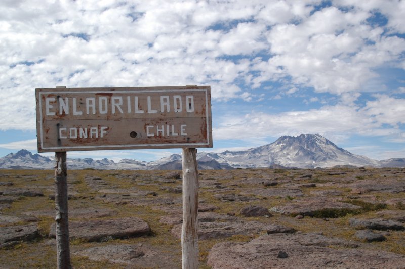
El Enladrillado and Volcan Descabezado
|
It felt like the top of the world. I’d hiked several hours along the Lircay
River and up a valley to El Enladrillado, a large plateau in the Chile’s
central cordillera where massive basaltic volcanic rocks are laid like Paul
Bunyan-sized stepping stones, to a stupendous top of the world overlook. From
my perch, the ground dropped as steeply as an elevator shaft to the Rio Claro
canyon, where the distant river looked like a tiny, curled ribbon. On the far
side of the river, the earth jolted abruptly skyward, rising even higher than
my vantage point to faraway sharp-edged peaks. Snow accented the irregular,
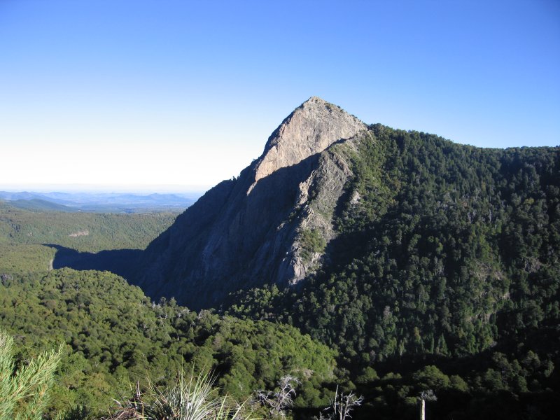
crudely carved blade-shaped summits. But most daunting of all was Volcan Descabezado,
or the decapitated mountain. Descabezado, at an elevation of 12,959 feet, is
what remains of a volcanic peak that, sure enough, looks like some giant had
used a machete to viciously whack its top off.
| “You’ll know it when you get there,” my daughter Molly had told me that morning as I stuffed water bottles, empanadas and other snacks into my daypack. Her cozy cabana, her home for two months, was 1-1/2 uphill miles from the headquarters administration office of the Altos del Lircay National Reserve in Vilches. Altos del Lircay is a park not many people know about. | 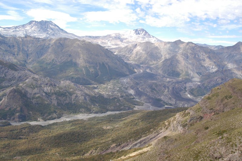 |
|
Rio Claro canyon and daunting Descabezado
|
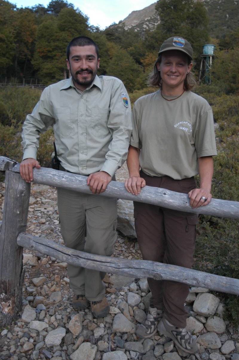
Osvaldo Barassi Gajardo, the park’s administrator who hopes to change
that, had a different take on Enladrillado. As he laughingly told me, “Everyone
asks me how to get to the mystery platform. The popular belief is the Enladrillado
is the alien landing area.”
 |
|
|
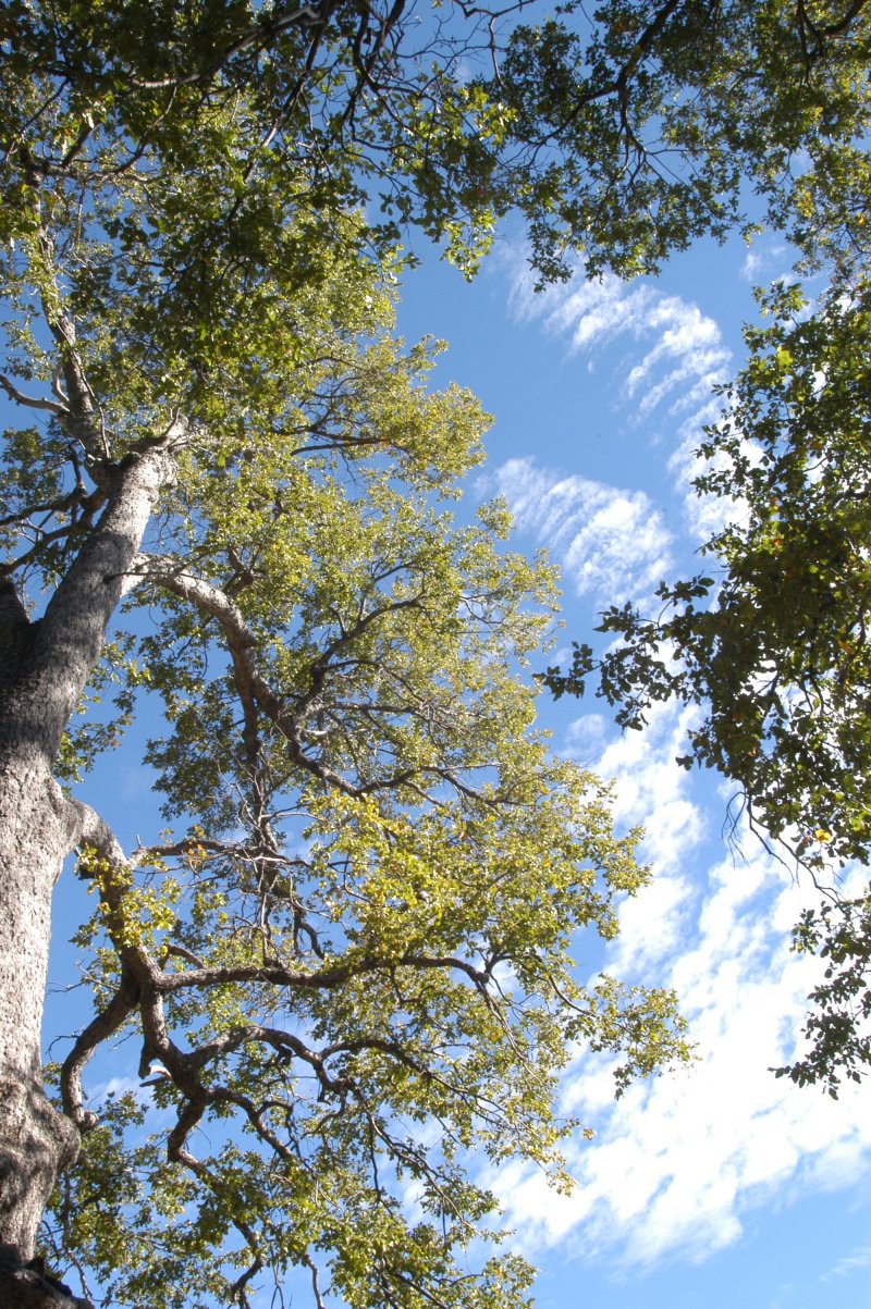
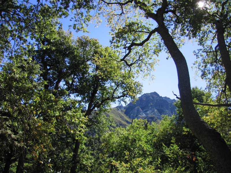
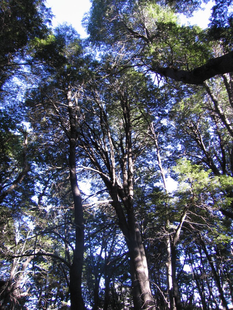
Native beech forests are Altos del Lircay highlight
|
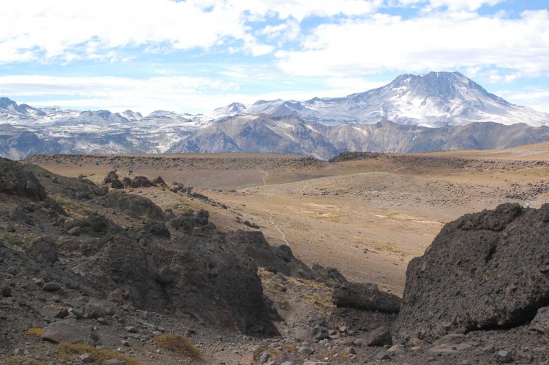
I landed at Enladrillado in mid-day, after more than four hours of trekking.
The route began along the Lircay River before steadily gaining elevation through
native beech forests. Up high, the vegetation thinned, exposing jaw-dropping
views of the valley below. Near the top, the trail flattened and forked west.
I continued climbing south, crossing El Enlardrillado’s huge flagstone
rocks to the mirador, or viewpoint. After savoring the view, and one of the
empanadas, I backtracked to the junction and followed the meandering ridgeline
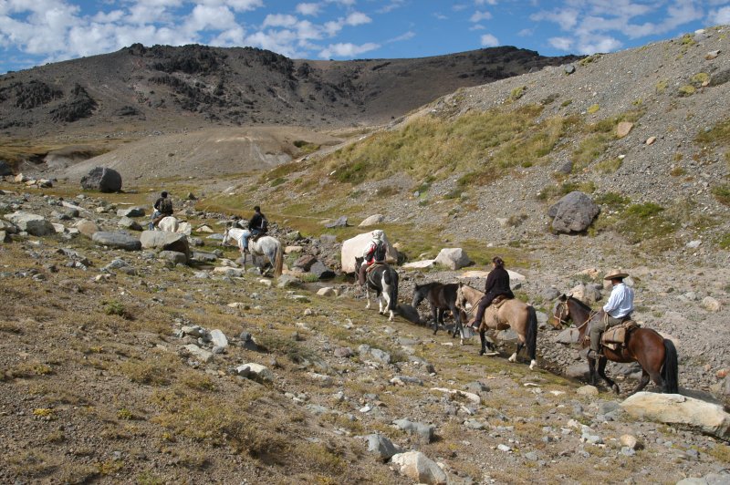
trail toward Laguna del Alto, a lagoon inside a volcanic crater. Along the way
I met a group of horseback Chileans. At a lake mirador I downed the second empanada
before following another trail that dropped down to the Lircay River and returning
to the cabana.
 |
 |
|
On the trail to Laguna del Alto
|
Horse group tours Altos del Lircay
|
Hiking to El Enladrillado was just part of the adventure that came with visiting Altos del Lircay, one of Chile’s little known national parks. The park was created in 1996 and has 36,704 acres of protected area. It’s best known for its native beech forests, endangered birds, archeological sites and diverse landscapes. The park has Andean condors, Loro triacahue (an endangered parrot) and megellanic woodpeckers, which are similar to pileated woodpeckers. Because it is located south of the equator, the best times to visit are October to May, with the best fall colors in April and May. Located 41 miles east of Talca, and Talca is about 145 miles south of Santiago, the park is used and appreciated by Chileans and, increasingly, hikers and backpackers seeking otherworldly experiences. Osvaldo said the park averages about 4,000 visitors a year, including about 800 foreigners from countries like Germany, Italy, Switzerland and Austria plus increasing numbers of Americans. I sampled only a few of the park’s hike. There are many short trails, and several multi-night backpacks. Popular, too, are guided horse packing trips.
“I want foreign people to know this place,” Osvaldo said. “They
have more of an ecological mindset when they visit. They don’t leave garbage.
This is one of the first places people can come to when they come to Chile.
If they come, they can learn about and get a good impression of our country.”
 |
|
|
Osvaldo and Molly
|
My good impressions began the afternoon I arrived. While Molly cooked dinner,
I crossed the road from her cabana for a short, steep hike to a mirador that
overlooks the Lircay River, forest canopy, the dramatic Los Coigues Gorge and
lowlands that fanned out toward Talca.
 |
|
|
The view into Los Coigues Gorge
|
The good feelings continued. Another morning I wandered into the Antahuara
campground, with its 30 spacious sites with water, picnic tables and electrical
outlets (light bulbs are provided by the rangers) and a bathhouse with flush
toilets and hot water showers. From campsite 23 a short trail leads to an aerie-like
mirador that peers into the Los Coigues Gorge. From the campground I followed
a trail that dropped into and across the Lircay River and meandered through
verdant beech forests until the route forked into increasingly indistinct game
trails. The varieties of beech are fascinating, but my favorite were the cougie,
large trees with distinct bark and, sometimes, branches that seem to share caressing
embraces with neighboring cougies.
 |
 |
|
Beech forests seek the sky
|
Another day I joined a hike with Molly, park ranger Carlos Reyes Gonzales and
30-plus college students from Santiago and Concepecion. We followed a road from
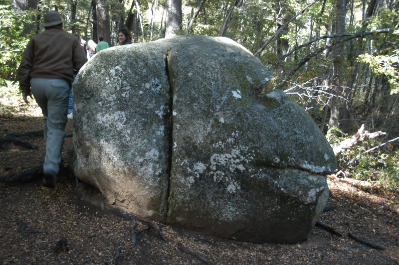
the administration building to a trail that weaved up the White Rocks. Along
the way, we paused at the piedras tacitas, bowl-shaped holes in the otherwise
flat rock surface where pre-Columbian inhabitants used to communally grind corn,
and a rock that looked like the face of a monkey.
 |
 |
|
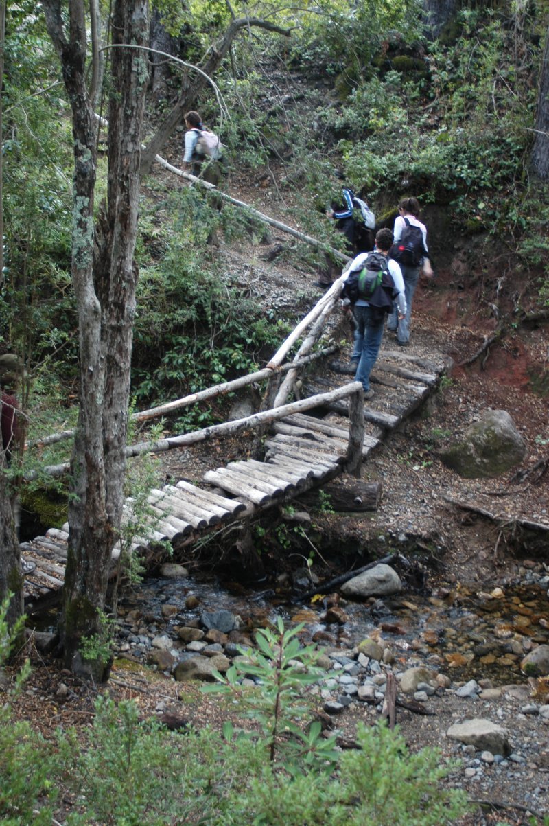
Hiking across a bridge to the White Rocks
|
Monkey face rock
|
* *
Getting to the park, as I learned on my various circuits, is itself an adventure. The route between Talca and Vilches is traveled by old buses that would probably be sold for scrap metal in the U.S. The first hour out of Talca passes along vineyards and, as the route climbs, lush forests. But the last hour is a bumpy, bus pulverizing, shake-away-the-pounds rocky road. During one of my rides up from Talca, the notes I tried to write in my journal are barely legible - crazed, schizophrenic, hieroglyphic-like scribblings. During my circuits, I rode with children headed to school, women in business suits, men wearing distinct wide-brimmed flat felt hats, families toting months worth of groceries, a man carting a chainsaw, another man on crutches who, when he debarked, retrieved a large bag of dog food from the bus that he had to somehow haul home. As my journal tells, “People smell of soil, of work, of sweat from hard labor. Not a bad scent, but the aroma of life. The chainsaw man had hands as black as gloves. Kids are often butterballs, wrapped in hats and jackets because of the cold.
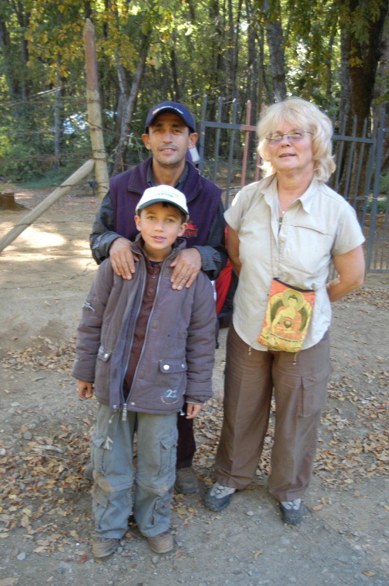
On my last ride out of the park Molly and I joined Vidal Aware, a Chilean native
who lives in Australia and spent several days camping and hiking with his son,
Miguel, and mother-in-law, Yvonne Miles. As a young boy during the 1973 revolution,
his mother left Chile with his two sisters. Vidal stayed with his father, who
was shot and killed, apparently by General Augusto Pinochet’s notorious
squads. Vidal lived several years in an orphanage until moving to Australia.
He remembered visiting Altos del Lircay as a boy, before there were roads and
trails.
 |
|
|
Park visitors Miguel and Vidal Aware and Yvonne Miles
|
Molly and I had planned to hike unmarked backcountry trails with Osvaldo from
Altos del Lircay to the neighboring Radal Siete Tazas National Reserve. When
Osvaldo had to cancel, she and I instead rode a series of buses to Talca, Curico,
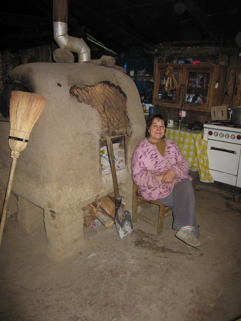
Molina and finally Radal, a village near the park entrance where we stayed in
a primitive house with hard-packed dirt floors, chairs carved from trees and
flickering lights.
 |
|
|
Living the simple life in Radal
|
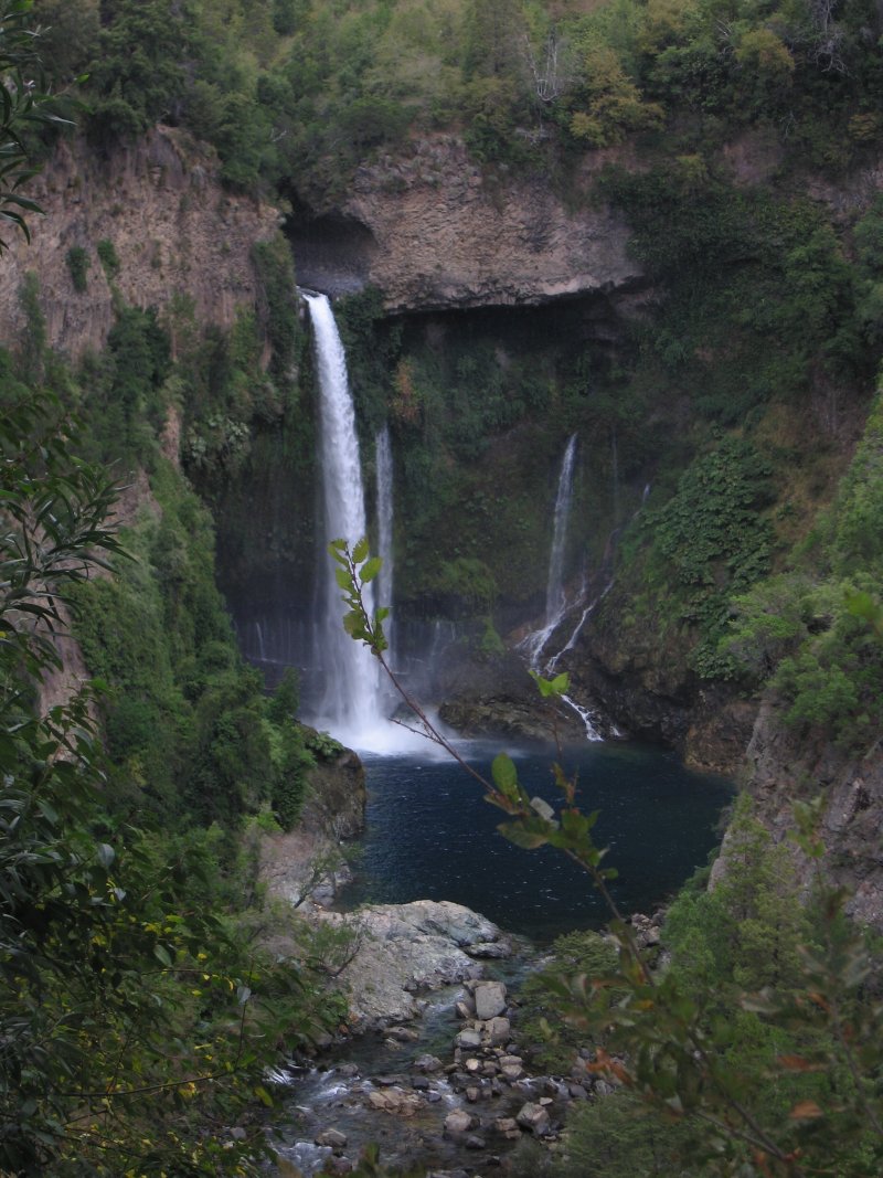
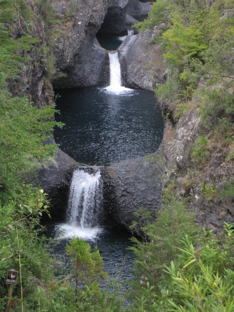
Radal Siete Tazas, or seven teacups, is a 11,324 -acre park. Over millions
of years waterfalls along the River Claro have carved the seven teacups. We
hiked first to beautiful Bride’s Veil Falls. At Seven Tazas a trail plunges
into a deep gash in the narrow river canyon. From a mirador and, further down
the trail alongside the river we viewed a series of the frothy falls that splash
into the tazas. Because of the tight-fitting canyon only a few of the falls
and tazas are visible.
 |
 |
|
Bride’s Veil Falls
|
A series of tazas, or teacups.
|
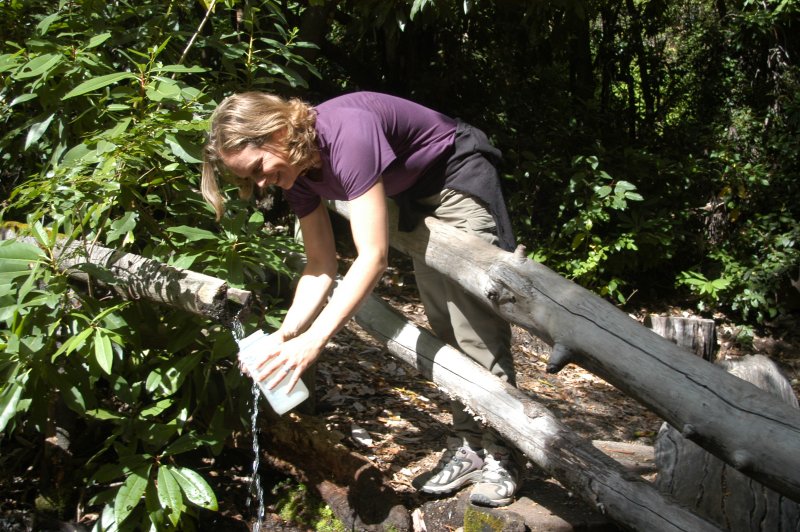
From the headquarters Molly and I followed a loop hike, the Sendro Chiquillanes,
another steep trail. We stopped and drank ravenously at a place where deliciously
chilly water dropped from a carved wooden sprocket. Further along the trail
we viewed Descabezado.
 |
|
|
Molly sampling water
|
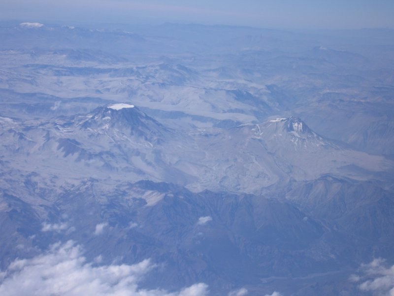
Several days later, while flying from Santiago to southern Chile on an unusually
clear day with only a smattering of clouds, I was treated to yet another view
of the decapitated mountain. From the airplane’s window I looked down at
the landscape that is Altos del Lircay and Radal Siete Tazas. Rising like a
ghastly obtrusion was Descabezado, shorn summit and all, and leading to it was
the massive blocky walkway that is El Enladrillado. There wasn’t a space
ship in sight.
 |
|
|
Descabezado and Enladrillado sans space ship.
|
When You Go
Several airlines fly from various U.S. airports to Santiago, Chile’s capital
city. From Santiago, buses and trains make frequent trips to Talca, about 145
miles south. Motorists can follow Highway 5, the Panamerican Highway. From Talca,
people with cars can drive through San Clemente to Altos del Lircay. People
using public transportation can catch buses from Talca to Vilches, which is
the end of the bus line. The frequency of buses varies by the season. The park’s
heaviest use seasons range from October to May, or spring to fall in South America.
Information about camping, backpacking, day hiking and picnicking is available
at the administration office at Vilches, often only in Spanish. Be prepared
– there are only very limited food services available near the park.
Lee Juillerat is a writer-photographer for a daily newspaper in Southern Oregon and frequent contributor to Northwest Travel, Oregon Coast, Range, Horizon and Alaska airlines in-flight magazines and several other publications. He has written two books about Crater Lake National Park and contributed stories and photographs for many books and calendars. He has written about hiking, skiing, climbing and traveling throughout the U.S along with Switzerland, Wales, France, England, New Zealand and Chili for High On Adventure for more than a decade. He can be contacted at lee337@cvc.net.