 |
|
TREASURES OFTHE YUCATÁN PART 1: PALENQUE TO IZAMAL |
|||
Story by Vicki Hoefling Andersen; photos by Andersen unless otherwise attributed |
|||
Most of Mexico’s Tren Maya (Maya Train) is now operational (see Transforming the Yucatán: Arrival of the Tren Maya https://highonadventure.com/hoa24may/vicki/transforming-he-yucatan.htm), transporting locals and visitors along its seven routes in five Mexican states. Six new hotels, similar to the grand lodges built for train travelers in the United States and Canada around the turn of the 20th century, are strategically located within short or walking distances from important archaeological sites. Routes pass through eight Pueblos Mágicos, so-designated for their “magical” qualities such as exceptional beauty, historical importance or natural wonders. There are six Biosphere Reserves, five protected Natural Reserves and nine National Parks to explore. The Gulf of Mexico and the Caribbean surrounding the Yucatán are rich in marine life. Coastal islets provide nesting sanctuaries for a multitude of winged critters, and the world’s second largest coral barrier reef lies just offshore. SECTION 1, called the Selva Tramo (“Rain Forest Section”), runs between Palenque, Chiapas and Escárcega, Campeche and is noteworthy for the rich biodiversity and the archaeological significance of Mayan areas along the route. Much of the 140-mile journey traverses tropical rainforest including the Lacandón jungle and the 1.8 million-acre Calakmul Biosphere Reserve. Richly scented with mahogany, cedar, nutmeg and guaya, the air is alive with nearly 1,200 different butterflies and nearly 600 avian species, in addition to troops of spider and howler monkeys swinging through the canopy. Palenque is designated a Pueblos Mágicos in tribute to the amazing nearby natural wonders and access to the Palenque Archaeological Site which flourished as a major power in the seventh and eighth centuries. Less than five miles from town and surrounded by the 4,200-acre Palenque National Park, this UNESCO World Heritage site is known for its exceptional and well-preserved carvings and sophisticated architecture. The on-site museum has been enhanced with more information and new discoveries. The Hotel Tren Maya Palenque is one of the new lodgings built to accommodate visitors. (For more about Palenque Archaeological Site, check out my story Palenque, Mexico https://www.highonadventure.com/hoa16jan/vicki/palenque.htm)
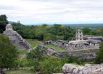
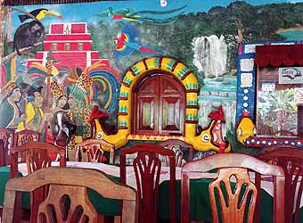
Palenque’s Temple of the Inscriptions overlooks the massive Palace, a construct that includes 15 buildings, rambling courtyards and countless chambers built atop a 33-foot-tall platform. The four-story Tower in the center of the Palace complex is unique in the Maya world. Local restaurants celebrate the region’s history and natural wonders with colorful abandon.
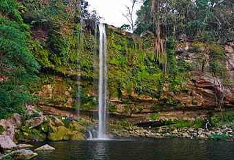
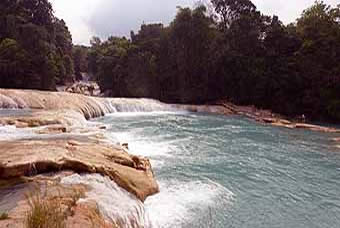
Enchanting waterfalls with picture-perfect pools inviting a dip are an easy drive from Palenque. The 115-foot cascade at Misol-Ha Waterfall Natural Park is just 12 miles away, and Agua Azul National Park with its series of waterfalls spilling over a limestone stream bed is about an hour-and-a-half drive.
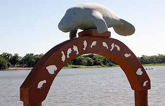
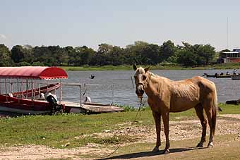
Less than 25 miles from Palenque, the picturesque town of Playas de Catazaja (Mayan for "valley covered with water") is best known for its 60-square-mile system of waterways, islands rich in bird and aquatic animals, and home to manatees and some impressive fishing.
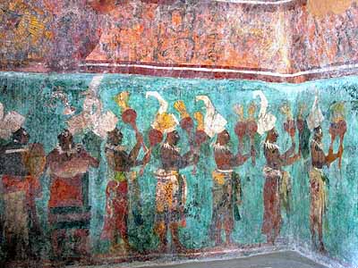
Surrounded by a thick canopy of sapodilla, mahogany and palo blanco trees, Bonampak Archaeological Site is about 3 hours from Palenque. A Maya ceremonial center famous for its Templo de las Pinturas, the small 3-room structure contains the finest surviving Maya murals yet known and depict court life and rituals, battles and sacrifices, musicians and celebration. Evidence of deity pots, censors and copal offerings from recent times reveal the site’s ongoing use as ceremonial center by the modern Lacandón Maya.
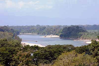
The train station at Boca del Cerro enables a visit to the Montes Azules Biosphere Reserve, arguably Mexico’s most biodiverse region. From Tenosique, Tabasco you can enjoy birding and rafting on the Usumacinta River, a 620-mile waterway dividing Mexico and Guatemala and a major trade route for the ancient Maya. Hop off the train in Candelaria, a Pueblos Mágicos that celebrates its beauty in the heart of the Lacandón jungle, and discover an ecotourism paradise. The city offers a cornucopia of outdoor activities: bird watching, cave exploration, indigenous communities, Pedro Baranda springs snorkeling, La Misteriosa lagoon boating, and the El Tigre archaeological site. SECTION 2, the first portion of the Tramo Golfo or “Gulf Section,” - the full route runs 405 miles from Escárcega to Izamál - takes travelers to Calkiní. Its interesting adventures range from archaeological sites to colonial towns.
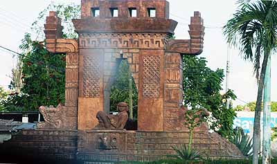
Known as the Escárcega, “Forest Capital of Mexico,” Escárcega is the perfect location for a terminal continuing the town’s tradition as an important transportation and trade center. The Puerta de Entrada al Mundo Maya or “Gateway to the Mayan World” is a reminder of the region’s long and rich history.
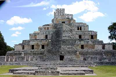
The station at Edzná offers a Tren Maya Hotel and makes it easy to visit this 2,500-year-old site that has been the recipient of extensive preservation work, a new museum, and a Visitor Service Center thanks to the Tren Maya project. It is best known for its Temple of Five Stories which combined pyramids and palaces into a 100-foot-tall behemoth.
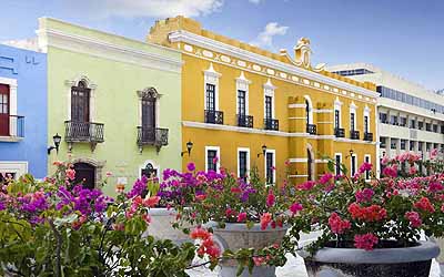
San Francisco de Campeche, a port city and UNESCO World Heritage site on the Gulf of Mexico, is the location of another Tren Maya station. Founded in the 16th century by conquistadors, the well-preserved Colonial city is honored for the excellence of its architecture. SECTION 3 of the Tramo Golfo route runs between Calkiní and Izamál, allowing passengers to explore the rich Mayan culture, colonial history and natural magnificence of the Yucatán Peninsula. Hop off in the colonial town of Calkiní where you’ll discover local handicrafts. Mexcanú is known for producing exceptional honey and habanero peppers. Saunter about Umán and you’ll find workshops constructing all sorts of colorful hammocks.
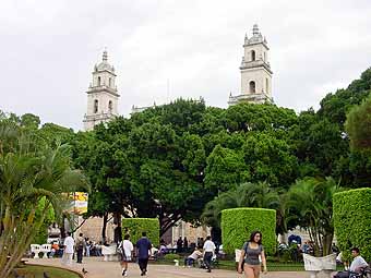
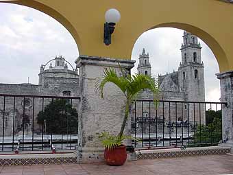
Easy to access via international airport and a Tren Maya station, Mérida is the capital of the state of Yucatán. Once a Mayan ceremonial center called Acanceh, when the conquistadores arrived in 1542 the city’s five white limestone pyramids reminded them of Mérida. In “celebration” they renamed the city, destroyed the structures, and used the rubble to build their churches and mansions, becoming one of the first strongholds in New Spain. The Cathedral de San Ildefonso overlooks Mérida’s Plaza Mayor, a tranquil respite that has seen bullfights, religious processions and the swearing-in of Spanish kings.
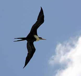
Sixty-six miles west of Mérida is the 146,000-acre Río Celestún Biosphere Reserve, a massive mangrove wetland of coastal beaches and dunes abounding with birds and other wildlife. Just 28 miles north of Mérida and 65 miles offshore from Progreso lies Arrecife Alacranes National Park & Biosphere Reserve, aka Scorpion Reef. Five small islands form the largest (824,600 acres) coral reef in the southern Gulf of Mexico. A large population of magnificent Frigate birds nest on this atoll, their seven- to eight-foot wingspan allowing them to stay aloft up to two months at a time, even sleeping in the air.
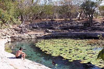
Many people claim X´lakah Cenote to be the most beautiful in the Yucatán. Located in the 1,235-acre Dzibilchaltún National Park 15 miles north of Mérida, the city flourished as one of the Maya’s great urban centers in the northern Yucatán, inhabited continuously from about 800 BCE until the arrival of the Spaniards. The on-site museum has been revamped as part of the Tren Maya project.
Mayapán, 25 miles south of Mérida, controlled the northern Yucatán and was the last important Maya capital from about 1200-1450 CE. Enclosed by a 5-mile long defensive wall averaging 19 feet thick, the city includes a structure appropriately monikered Room of the Frescoes, with two walls of colorfully painted murals. Fifty miles south of Mérida, a group of ancient Maya cities have been designated a UNESCO World Heritage site known collectively as the Puuc Route, covering 25 miles from Uxmal to Labná. Puuc-style architecture features rubble-filled walls faced by a thin veneer of finished stone. Lower facades of exterior walls are plain while the upper portion is decorated with long-nosed masks of the Maya rain god Chaac, and geometric designs made of individually carved pieces that resemble a mosaic.
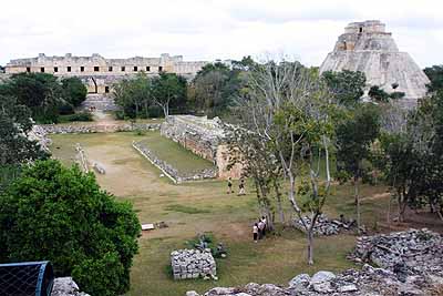
Uxmal is the largest and most fully-excavated and restored of the Puuc sites, and boasts the Hotel Tren Maya Uxmal. Inhabited from 800 BCE to 1150 CE by as many as 25,000 inhabitants, it was an economic and political power. Among the fifteen groups of buildings covering more than 250 acres, the House of the Turtles affords an elevated view of the Ballcourt in the foreground and the Nunnery Quadrangle and Pyramid of the Magician in the background.
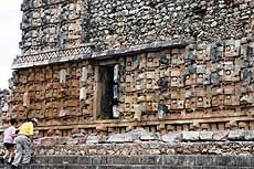
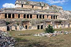
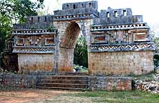
About 14 miles from Uxmal, Kabáh may have been almost as large as Uxmal but only a small portion has been excavated. The Temple of the Masks (above left) is a splendid example of stone mosaic work, its 151-foot long façade a collection of 250 Chaac masks. Seven miles south and noted for its particularly harmonious architecture, Sayil’s Grand Palace (above center) is three stories tall with a 280-foot façade and contains approximately 90 rooms. Three miles further is Xlapak, smallest of the Puuc sites and busy with ongoing excavation and restoration work. Two miles further brings you to Labná whose 42-foot-wide by 20-foot-tall lavishly ornamented archway (above right) once led into a courtyard surrounded by edifices that no longer exist.
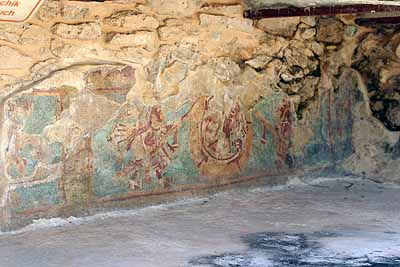
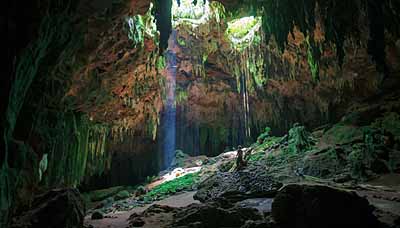
The Loltún Caves, about 68 miles southwest of Mérida, are the largest in the Yucatán and extend over a mile, and are filled with stunning natural formations and ancient Maya paintings. Artifacts such as tools and animal bones, including mammoth, are evidence of occupation stretching back more than 10,000 years.
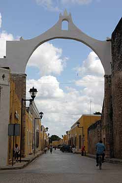
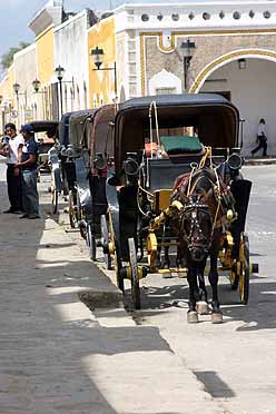
Terminal of the Tramo Golfo section, Izamál’s cultural heritage led to its inclusion as a Pueblos Mágicos, and is sometimes referred to as a town of three cultures because of its blend of pre-Columbian, colonial and modern civilizations. It is also referred to as the Yellow City because the buildings in its historical center are painted yellow. The city is dominated by the Basilica of San Antonio de Paduan built in 1553 atop the base of the largest of four main Maya pyramids.
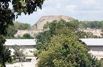
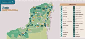
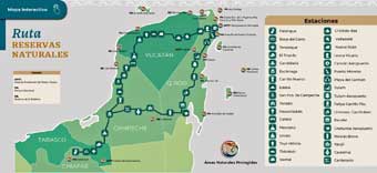
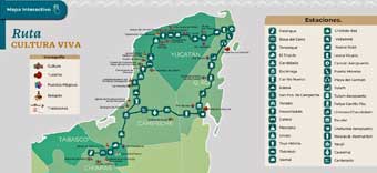
The Pyramid of Kinich Kak Mo is the only remaining evidence of Izamál’s Mayan past. It stands 118 feet tall with a base measuring 670 feet on each side, but the base is hidden by modern buildings. Occupied continuously from about 300 BCE, the city was dedicated to the Mayan Sun God Kinich-Ahau and Itzamná, God of Creation. Watch for “Treasures of the Yucatán Part 2” covering Chichén Itzá to Escárcega in the next issue of HighonAdventure. Meanwhile, here are some Tren Maya maps (courtesy of trenmaya.gob.mx)
ABOUT THE AUTHOR
|
