JANUARY/FEBRUARY 2025, OUR 29TH YEAR
SCENIC DRIVING WASHINGTON, Pt. 1 |
||
Story and images by Lynn Rosen and Steve Giordano |
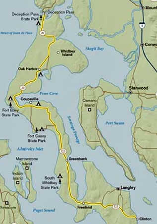
Let’s give you an abbreviated preview of how this guide can help steer you through the byways to find some interesting features on your trip. This particular scenic drive is Drive #6, Whidbey Island, a 60-mile drive that takes you across one of Puget Sound’s many islands. Whidbey Island can be reached by ferry in the south or by bridges that connect it to the mainland in the north which is where Deception Pass State Park is located. Either way you choose to reach the island, there are spectacular viewpoints and must-see attractions along the way. This island drive includes rural turn-of-the-century towns, shorelines, and pastoral landscapes, but if you’re coming from the south, it begins with a 20-minute ferry ride. Catch the Washington State Ferry from Mukilteo (from I-5 north of Seattle via SR 525 or SR 526) to Clinton on Whidbey Island. Check ferry schedules for sailing times as they change from season to season. You might want to stop at the waterside town of Langley first. Head 3 miles north on WA 525 and turn right onto Maxwell Road. With its numerous antique shops and boutiques, Langley hugs the water of Saratoga Passage and offers a pleasant downtown waterfront park. Campers are traditionally welcome at Langley’s Island County Fairgrounds, 819 Camano Avenue. Check to see if the camping area is open when you plan to visit. Have a look at the sweet sculpture on First Street, created by the same artist who did the bronze pig for Seattle’s Pike Place Market. This life-sized bronze sculpture depicts a boy and his dog looking out over the railing to the Saratoga Passage; his dog holds its head up with a ball in its mouth. Seawall Park in Langley is a good place from which to watch bald eagles, sea lions, otters, great blue herons, and sometimes a visiting pod of orca whales that often travels to Saratoga Passage for early fall feeding.
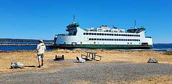
Let’s now skip north halfway up the island to another iconic sight on Whidbey Island, Fort Casey State Park at Keystone Harbor, the landing for the ferry to the Olympic Peninsula, and the nearby site of the historic Admiralty Head Lighthouse located on Admiralty Inlet. Continue driving north on 525 to Keystone Spit on your left, where, adjacent to the ferry landing breakwater, you may see scuba divers preparing to enjoy the underwater park there. The beach is steep gravel, and tough to navigate while wearing heavy diving gear. It is worth the effort since nothing quite compares to coming face-to-face with a wolf’s head eel 30 feet down under.
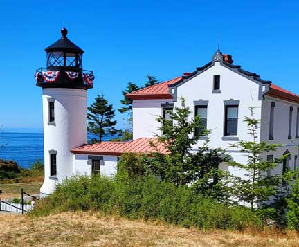
The Admiralty Head Lighthouse, first built in 1861, then re-built in 1903, no longer in active use, now features a gift shop, historic museum, and information center for tourists. This navigation aid has seen many “keepers’ and their families living here, keeping ships safely on their charted paths.
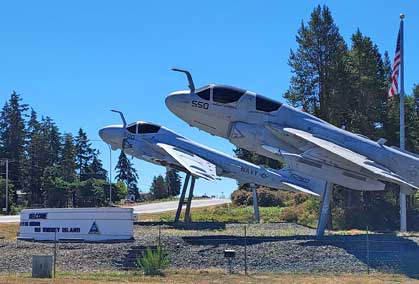
Now traveling north on SR 20 toward Deception Pass State Park, you pass by the Naval Air Station Whidbey Island north of Oak Harbor, which has long been an important ingredient in Whidbey Island’s culture and economy. The airborne Navy originally located here in 1942 because of the allegedly good flying weather, but there have recently been issues raised about the noise impacts on surrounding communities and wildlife.
Park officials say that up to 4 million people a year come to Deception Pass State Park. Even on weeknights, the 310 campsites are often filled. The more than 4,200-acre park is renowned for its old-growth trees, eight islands, sandy beaches, swimming lakes, and boat launches.
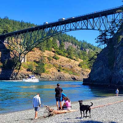
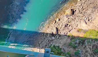
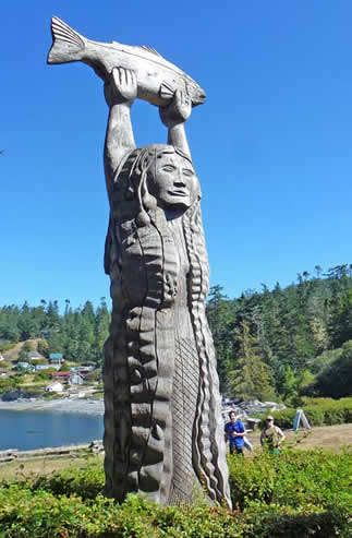
The rushing waters are quite a sight from the bridge, 182 feet up. It is well worth parking at the convenient lot and taking a breath-taking walk onto the bridge. The midpoint of Deception Pass Bridge is Pass Island. It is part of the park, as are Deception Island west of the park in the Strait of Juan de Fuca and Spy’s Island, the tiny one just below Deception Island. Some scuba divers/adventurers are known to “surf” the currents 80 feet below sea level, but even they have power boats waiting on the other side. The park’s facilities and roads were built during the Depression, and the larger crowds of today have had an impact on some of the trees. The damage is caused by trampling undergrowth and compacting soil around roots, which can kill these trees. The park also has a few lakes, 30 miles of trails, marshland, sand dunes, and a few smaller islands. Black-tailed deer are common in the park, and bald eagles nest in the treetops. The park has 15 miles of saltwater shoreline, comprising all manner of rocky bluffs, coves, tide flats, and sandy beaches. Don’t miss the Maiden of Deception Pass story pole, located in the Rosario Beach area of the park. The carving depicts the story of Ko-Kwal-alwoot, a culturally important legend of the Samish Indian Nation.
About the Author
|
