 |
|
HIKING ALONG OREGON'S MCKENZIE RIVER |
|||
Dense Forests, Lava Fields, Wondrous Waterfalls and the Blue Pool |
|||
Story and photos by Lee Juillerat |
Authorʻs Note: The Lookout Fire, which began August 5, 2023, has resulted in the partial closure of portions of Highway 126 and Highway 242, the McKenzie Scenic Byway north of McKenzie, and prompted some evacuations. Included in the closure were the Blue Pool and Sahalie and Koosah Falls. As of August 21, the lightning-caused fire had spread to 11,174 acres. Several campgrounds, including two mentioned in the story, Ice Cap and Paradise, along with trailheads and recreation sites, were also closed. The closures are in effect through September 18, 2023. For updates visit the Willamette National Forest website at https://www.fs.usda.gov/main/willamette/.
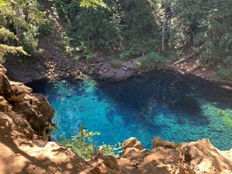
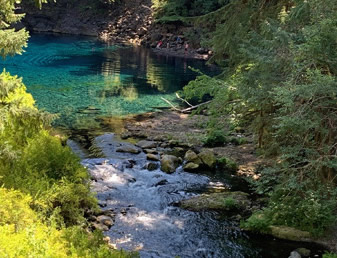
Our original plan was a multi-day backpack along the 26-mile McKenzie River Trail that, as the name implies, follows a portion of Oregon’s McKenzie River. What makes the trail tempting, and well-traveled, are its surroundings - thundering waterfalls, lava fields, old-growth forests and its single-most spectacular feature, the incredibly blue-blue Tamolitch Pool, better known as the Blue Pool.
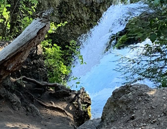
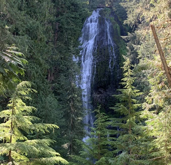
Several campgrounds along the McKenzie offer reserved as well as walk-in sites. Because we had a several- hour drive, Danny booked a two-night stay at the Ice Cap Campground, which is just south of Clear Lake, where the McKenzie Trail begins. Our large site overlooked the McKenzie River and Carmen Reservoir. Even better, it was just a short walk from the McKenzie Trail, during which we saw two dazzling waterfalls, Sahalie and Koosah,
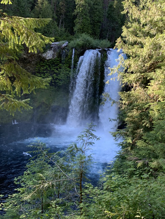
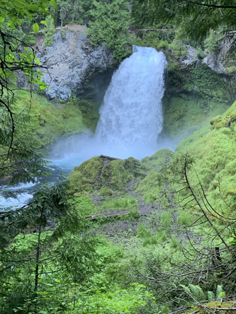
On our way to Ice Cap, we had briefly detoured to the Sahalie Falls parking lot, which was overflowing with cars. So, instead of fighting the mob, we set up camp, ate dinner, then made the less-than-a-mile stroll to the 80-foot Koosah Falls overlook. Wow! After wandering and gawking, we continued upstream, following the Waterfall Trail another half-mile to Sahalie Falls. When we arrived there, the parking lot was nearly empty. Gone, too, were the crowds at overlooks near and next to the thundering 100-foot-tall falls. The McKenzie was flowing fast and high, with a never-ending stream of whitewater plummeting along the river and over both falls. We continued another half-mile upriver for more views before returning to camp.
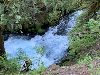
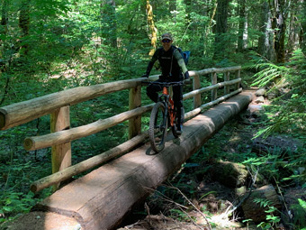
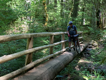
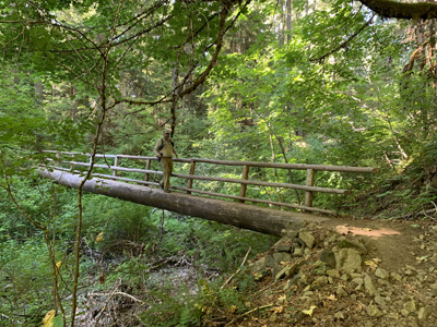
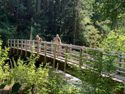
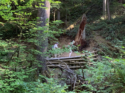
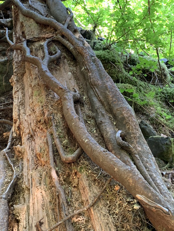
Just below Carmen Reservoir, the McKenzie disappears, channeling three miles downstream under lava deposited about 1,600 years ago. The was no river, but the trail leads through a lush, little-traveled old-growth forest. We saw no other hikers, but we did encounter mountain bikers, who often ride the 26-mile trail in a single day. This section includes several narrow “bridges” that cross over creek beds.
Whether reached and viewed from the north or south, the Blue Pool dazzles. Its blue-green waters defy description. A series of overlooks allow hikers to peer down to its unfathomably beautiful waters. From our vantage we saw people at the pool’s edge. Most stayed on pool-side rocks, but some jumped in for brief swims. The Pool’s average temperature is a chilly 37 degrees Fahrenheit, cold enough that some people go immediately into shock after jumping in. It wasn’t until we returned home that we learned that the Willamette National Forest has banned swimming in the Pool -- and for good reason. During a three-day-period earlier that month, rescue crews had carted off two people and, just a day before our hike, had rescued three others.
The next morning we drove downriver to the Paradise Campground. It’s an appropriate name. We didn’t find a riverside campsite, but happily settled in another spacious site. After a quick drive to the Belknap Springs Resort, we parked our car and hiked the 4-plus miles mostly through tall trees to our new camp.
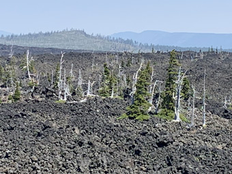
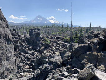
Our fourth day was our most ambitious. We drove up the Old McKenzie Highway, first to Proxy Falls. The loop hike began with nearly a mile-trek on a trail that goes alongside and through a basalt lava flow that amazingly transitioned to a lush forest, including old growth hemlock and Douglas fir.
A signed detour took us to an overlook for Lower Proxy Falls, a rumbling-tumbling, 100-foot-plus high waterfall. Back on the trail it was only about a quarter-mile to another junction, this one to Upper Proxy Falls. Upper Proxy is deceptive. The upper section of the 100-foot-plus falls is semi-hidden by trees and brush, before it openly plunges into a deep pool. Proxy is also unusual because water from the falls sinks though porous lava rocks below and into the ground.
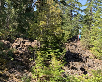
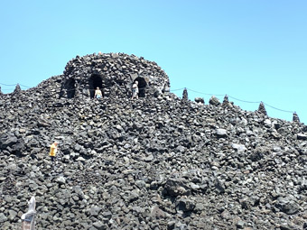
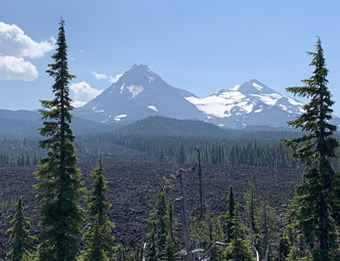
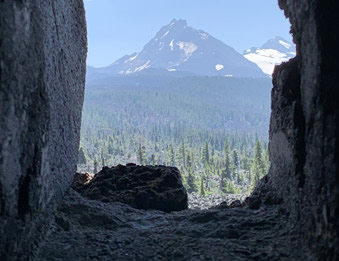
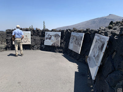
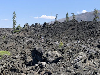
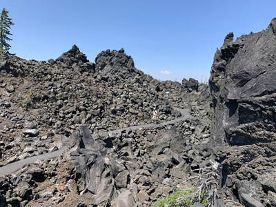
We next headed up the Old McKenzie Highway, which leaves the forest and enters massive black lava flows. Near the summit we stopped at the historic Dee Wright Observatory. Built in 1935 by the Civilian Conservations Corps, the lava rock structure offers panoramic views across 65 square miles of lava. In 1964, astronauts heading for the moon conducted drills on this moonscape-like landscape.
It was just a short walk to the observatory, which has openings that offer peeks of surrounding peaks, including Mount Jefferson, Mount Washington, and the North, South and Middle Sisters. Equally amazing is the Lava River National Recreation Trail, a paved, handicap-accessible loop trail that goes through lava fields. Interpretive signs along the trail, and the trail to Dee Wright, provide information about geologic formations flanking the trail.
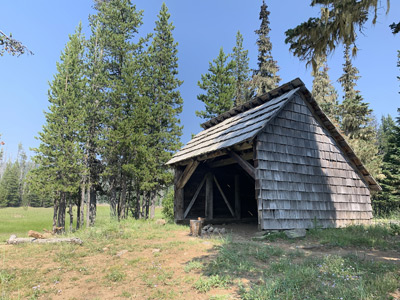
Yet another temptation lured us along another roadside trail to the Hand Lake Shelter. It was an easy half-mile walk to the rustic shelter on the trail. It passes through an alpine-mixed-conifer forest before opening into a large meadow near the three-sided shelter that overlooks Hand Lake and distant Mt. Washington.
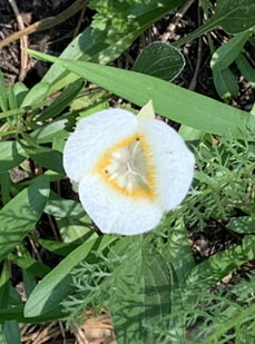
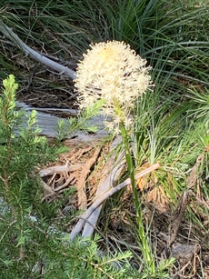
We crossed the meadow - one, colorfully vibrant with varieties of wildflowers - to a trail junction. After hiking west for a distance, we doubled back. Curious, once at the junction I continued east. The trail passed above and along Hand Lake’s north shore to the edge of a lava flow. There is an historic section of the trail, which crosses the lava and eventually loops back to the shelter.
By day five it was time to return home. Steve headed off early while Danny and I enjoyed a leisurely morning before heading along the Aufderheide Scenic Byway – Forest Service Road 19 – which connects the community of McKenzie River with Westfir and Oakridge and winds alongside sections of the McKenzie River. About the Author
|