| |
|
October has always been my favorite month. The crisp air, the ripe apples, the many overlapping sports seasons, (college football, world series, NFL) but most of all the foliage and the gorgeous weather. I have spent this month in many states: Indiana, Kentucky, West Virginia, Washington, Oregon, Ohio, Louisiana, and all were wonderful. In 2020, I took a road trip through Northern California to explore the scenery and
visit family and friends, and here is what happened on that journey.

Mt. Lassen
Stop One: The High Country
Who would know that such a cute critter could be so dangerous? As I pulled in to Lassen Volcanic
National Park, a beautiful campground in the southern Cascade range in Northern California that I have visited several times, I was greeted by a poster showing a young girl with a bloody face due to an attack by … a river otter! This isn’t how I expected my trip to begin.
These otters are in the Mustelidae family, which includes badgers and wolverines, both ferocious omnivores. It made me super-cautious on my loop-hike around Manzanita Lake. I’d left home in Chiloquin, Oregon, around noon, and been on the road for five hours, taking the backroads through the scenic and rustic farm towns of Bieber and New Bieber. (For the whole adventure route, see the map at the end of the article.)
This was mid-October, so the days were getting shorter and the nights colder, especially up at 6,720 feet. I could hear other people in the campground, but couldn’t see them. It had been a long, late and
grueling fire season, with massive conflagrations all around the region, so no campfires were allowed. It
would have been comforting on a chilly night like this, but I just sank into my bedroll in the back of my
truck after a cold supper and read “Lonesome Dove” by flashlight, thankful that I avoided any ferocious
otter encounters. They are crepuscular hunters.
The morning was brighter and cheerier, though most of the other campers had left, except for
somebody playing guitar whom I couldn’t see. It was a young man on a cross-country adventure in his
pickup with no particular destination. It made me wistful for the days when I lived that way, but also
grateful for still being able to do it at age 51, albeit in a truncated version. We were kindred spirits, so I
congratulated him on taking risks and front-loading life.
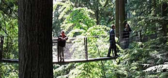
Then, off with the sneakers, on with the big boots, to Echo Lake, starting from the Summit Lake
trailhead. Fortunately there were no otter warnings, so I set out briskly, forgetting that I
was hiking at 7,000 feet. I’m in good shape and live at 4,200 feet, but I could feel the altitude’s impact, so I
measured my pace. I still had three miles to go up, and then back.
The slower pace gave me more time to take in the scenery of high peaks and aspen groves flaming gold.
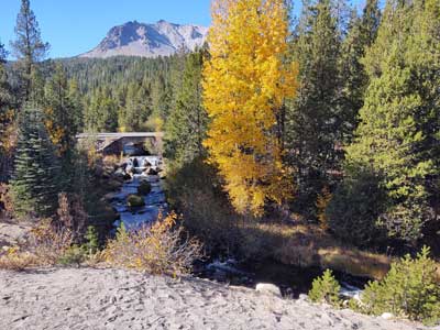
View of Mt. Lassen
I met a nice family at Summit Lake. Fortunately, they arrived after I went skinny-dipping. It was bracingly cold, but tolerable, and the brisk return hike warmed me right up.
It was mid-afternoon, and my journey was taking me south so I wanted to get on the road before dark.
Being a National Park groupie, though, I had to stop at the visitor center on the way out. The building is only a few years old, spacious yet warm. And serendipitously, the gift shop was having an end-of-season sale, so I stocked up on stickers, magnets, postcards and a new ball-cap. I’m always losing those things anyway, or else giving them away, so it was good to have a backup supply.
Stop 2: A Quick Respite
On my way out of Lassen I spoke with two young women rangers and told them I was heading down to gold country. They suggested Quincy as a good stopping point that I could reach by late dusk. I set my
course and checked into a simple clean, comfy, and affordable motor lodge. Just as the rangers had
predicted, I was there before dark - but barely.
Quincy is a small mountain town, but there were some quality food options, so I had a good Mexican
dinner suggested by the night clerk. She was a sweet young woman, but just the opposite of my guitar
buddy. She was nineteen, had no car nor license, had never left Quincy in her life, and wasn’t happy
about it. I didn’t give a lecture, but just offered some quick perspective about the great wide world,
even just within a day’s drive of home, and some advice on how to make some exploration happen for her. Get your driver’s license! Then the desk phone rang, so - after my day’s good hike and now a full belly - I went to my room, read more “Lonesome Dave” and zonked out.
Stop 3: Met a Miner, Forty-niner
| |
Now, it’s on to Gold Country in the Sierra foothills, hoping that I had offered some kind of spark to the
young woman.
I was headed to visit my friend Tom, an archaeology buddy from 1992. We still keep in
touch. Tom was born and bred in Sutter Creek, the heart of Gold Country, and after a few years as an
“archaeo-vagrant,” as we called ourselves, moved back home, so he was the perfect local guide. He told me
to take Highway 89 down to Truckee (“otherwise it’s 80 miles of curves”), and gave me directions from
there.
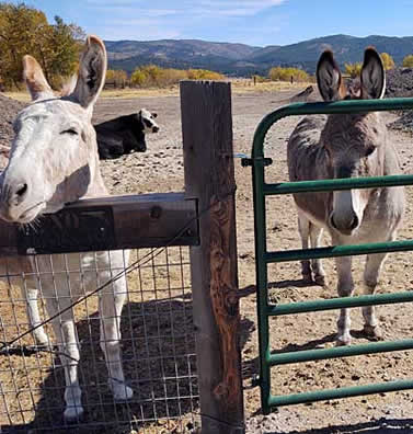
Along the way I stopped at a general store, the old-timey kind, and lingered while making some
new friends, that included a couple of hungry and curious donkeys. Sure, I can spare an apple. |
|
 |
|
| |
|
|
Mining country donkeys |
|
Once again, I arrived at dusk, an early one this time, so I had some daylight to roam the streets of historic downtown Sutter Creek, where the gold rush of 1849 began.
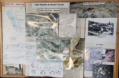
Sutter Creek gold deposits graphic
The next day we set out on a guided tour. “You know,” said Tom, quite rightly, “this place really helped make America.” (For an explanation of why California is so large, visit Directions Magazine.)
I drove as Tom navigated and interpreted. Our first stop was in the town of Volcano, at Indian Grinding Rock State Historic Park, where the native Miwok Indians had lived for centuries. There was also a reconstruction of a Miwok village
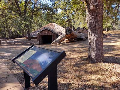
Miwok Village reconstruction at Indian Grinding Rock State Historic Park
as well as petroglyphs on the grinding rocks where the people ground acorns, one of their primary food sources.
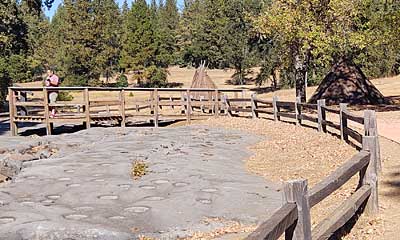
Grinding rocks at Grinding Rock State Historic Park
The next stop sent chills down my spine. From the overlook all that is visible is a shaft-house among the oaks and pines.
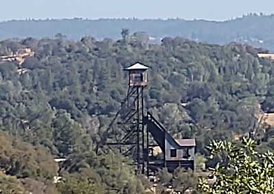
Shaft-house
Now long abandoned, the shaft-house took gold miners as deep as a mile under the earth along narrow tunnels to the ore pockets where they mined the gold that fueled America’s economic growth.
Many miners died in those deep shafts in fires and collapses, most of them Serbians.
The Serbians were a thriving community there, and built the St. Sava Serbian Orthodox Church in the heart of town. Unfortunately it was closed when I was there, but an interpretive panel at the shaft-house overlook showed the magnificent icons and frescoes that still beautify the church’s interior, despite its humble exterior.
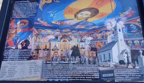
St. Sava Serbian Orthodox Church interpretive panel
Whenever I visit California, I am awed at how water is managed and moved around. We stopped at a
museum where a forty-foot high wooden waterwheel was displayed. Tom explained it was used to
move the toxic water from a refining process uphill into a tailing pond that still exists. Gold may be
pretty, but the by-products of its production are not. At another overlook, we saw a reservoir that
provides water to Oakland, CA, and the rest of the East bay area, a hundred miles away.
After a fun, busy and informative afternoon, my local guide took us to a burger shack, one of his
favorites since he was a kid. “Bacon burger with cheese and grilled onions,” he said, so I followed his lead.
It proved hefty enough that I had enough bites for a midnight snack. Finally we ended up back at Tom’s and said goodnight.
Stop 4: Not a Miwok Village
Tom had the day off, but I needed to head northeast to see my in-laws and friends north of Sacramento. Matt and Anita may own the place, but it is clear that Elanor runs the roost.
Not a miwok village
Precocious beyond her five years, she gives me the grand tour, leads me to my room, shows me hers, and starts giving me orders, which I gladly obey. “I need my trike, we’re going to build a castle with these red cups, etc…”
The next day we visit the Aerospace Museum of California in North Highlands located on the former McLelland Air Force base, which has been converted
to an office park, restaurant and hotel. (Highly recommended, IMHO, but in a sketchy neighborhood.)
There we meet Ron and Audrey, two of my work colleagues, so new connections are made between the
two families. There are dozens of planes and other aircraft, but Elanor’s favorite was the Hubble
Telescope exhibit, which was staffed by a docent who used to work on the program for NASA.
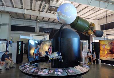
Aerospace Museum of California
Stop 5: Homeward Bound
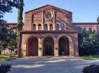
After two previous nights of sleeping in my truck and eating road food, I was now getting spoiled here at the “in-law resort,” so it was time to move on back down the road, winding north toward home. After a leisurely family brunch, I left late and realized I wouldn’t make it home by dusk. So I headed toward Redding where I could pick up I-5, but made a stop in the lovely college town of Chico, which was uplifting on a sunny Sunday afternoon.
| |
Chico State College buildings |
|
Campuses are usually quiet on Sunday afternoons, but I met a nice group of young students from Alaska as I strolled along the bubbling creek amid the mission-style buildings.
Then it was on to Redding, again arriving just before dusk, and found a nice motor lodge downtown
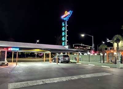
Redding Thunderbird Lodge
after I asked another traveler, “Is this place safe? Sure, I’ve stayed here lots of times.” Then
she clued me into a doughnut shop around the corner. Well, I should eat a real dinner, but … I could
smell it from a block away. Doughnuts for dinner? My nose and stomach overruled my brain. Sure, I’m
on vacation!
Stop 6: Destruction and Discovery
The next stop on the tour, on a sunny Monday morning, wasn’t as happy, but it had to be done out of
respect. To the west of Redding is Whiskeytown National Recreation Area, a unit of the National Park Service. I have many friends and colleagues who now work there and have worked there in the past. In 2017 a massive wildfire roared through the area for weeks, destroying the landscape and also homes, including those of several of my friends. It was heartbreaking to see the devastation, but despite losing their homes, my friend Jane and her other coworkers survived.
| |
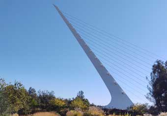
On that less than uplifting note, I cheered up with a visit to Turtle Bay Exploration Park in Redding, a family-friendly, wheelchair-accessible combination of a museum,
botanical garden, zoo and the Sundial Bridge, the pride of Redding that spans the mighty Sacramento
River.
And during the hot summers, they sell the best sno-cones I’ve ever had. |
|
 |
|
| |
|
|
Redding Sundial |
|
Stop 7: Relief and Reverence
Mood improved, I took the back road to I-5 and began the arduous but beautiful 70 mile climb up to
Weed, and then toward home. Shasta Lake, which is in Whiskeytown National Recreation Area, is the largest reservoir in California. The hydraulics are far too complicated to explain here, but water from here goes hundreds of miles south to irrigate orchards and crops. The climb is filled with steep curves and
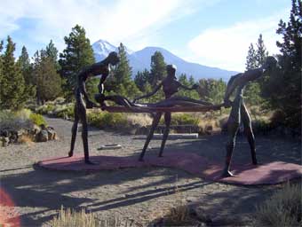
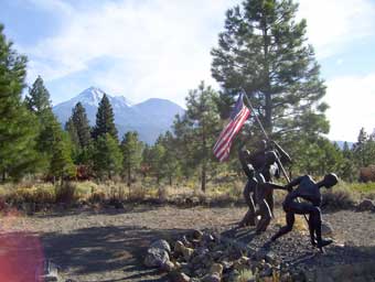
beautiful scenery, and I am always glad when I reach the top. A good place to take a breath and a stop is the Living Memorial Sculpture Garden, six miles north of Weed, CA. It is also a place to express reverence and gratitude for our veterans, especially the fallen ones.
| |
Thirteen different exhibits are spread out over 136 acres of USFS land. Nearly all are
larger-than-life welded metal sculptures. The nurses’ stretcher is about chest-height.
Sited underneath mighty Mt. Shasta, it is indeed a powerful place. |
|
Although filled with sadness for all my friends' losses from the fire at Whiskeytown, and the devastation at Lassen, I was also filled with gratitude. Everyone was still alive. But most of all, on that five-hour drive
home, I was feeling gratitude and hope. Gratitude for my friends and family, for having a reliable
vehicle, and most of all for this wonderful nation in which we can go wherever choose. And feeling hope that the young guitar player continues his life adventures, and that the young desk clerk begins some
adventures of her own. The road of life is filled with turns and forks, but it moves in only one direction…
forward!
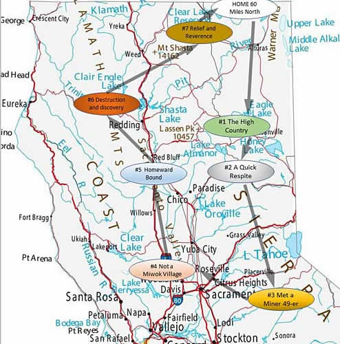
Map of author's trip
|
|
|