| |
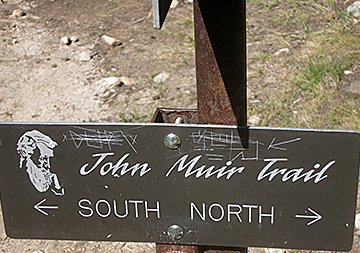
Along the John Muir Trail
| |
 |
|
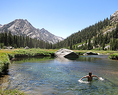
Three people I'd been playing leap-frog with earlier in the day were lounging in Grouse Meadow, lazily sprawled out along the banks of the Middle Fork Kings River. “Looks like you've found the best place ever,” I hollered as I walked past.
“Come join us,” they answered. So I did. An hour later, after a refreshing swim in the chilly river and shared chatter with three new friends, it was back on the trail.
The main allure of the John Muir Trail is its incredible scenery, sights that photos or videos can't replicate. But backpacking proved a shared experience. On some sections I was joined by friends and my daughter, Molly. Other times it was with new friends, including the Grouse Meadow trio. |
|
Getting on swimmingly with Alex
After joining them, Alex Navarrete, asked if I was going swimming, adding teasingly, “If you go in, we will, too.” I dove in. I reminded Alex of his pledge. He and one of his friends hesitated but jumped in, whooping and hollering, insisting it was the coldest water they'd ever experienced. But they were smiling and, after drying off, deliciously refreshed.
Before my swim I'd taken off my knee brace, something I wore whenever I was hiking. A hard plastic joint had carved a deep, ugly wound where my knee flexes. Although I washed it regularly, it had abscessed. Alex noticed, asked a few questions, then dug out large bandages from his first aid kit and handed them to me. Over the next few days, after applying Neosporin and covering the abrasion with a bandage, it gradually lessened. Alex and his friends reminded me to take care of myself and, more importantly, savor my surroundings.
| |
 |
|
Kevin Shea was like an unleashed puppy, excited and happily bounding about. We met the first day of the hike. He had planned to climb Half Dome but turned around after a storm brought the threat of lightning. During a break on the way to that first night's campsite, Kevin stopped and chatted, then scurried off.
Two mornings later he reappeared. He'd spent the night at Lower Cathedral Lake while my friend and I had camped at Upper Cathedral. At the Tuolumne Meadows backpackers campground, he reappeared. When I learned he had only limited food, I added some freeze-dried meals to his cache. Meetings with Kevin continued, sometimes on a daily basis, sometimes only every few days at places like Piaute Pass and Evolution Lake.
I wasn't totally surprised when, reaching Guitar Lake, where most John Muir Trail hikers camp before the final surge up Mount Whitney, I saw that Kevin was camped nearby. The next day, after yet another reunion atop Whitney, he tagged along for the descent to Whitney Portal.
I'd been even more surprised and flattered, when I reached Guitar Lake. As I reached the lake, a group at a campsite waved and chanted, “Lee, Lee, LEE!”
|
|
| |
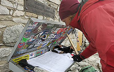
Kevin Shea atop Whitney's summit |
|
|
|
It wasn't just a "chants" encounter. The group included people I'd met earlier, including Marcus Crone and Dylan Hyder. Just before I left Tuolumne Meadows, they had hopped off a shuttle bus and asked for directions to the wilderness permit office. We were hiking past the office so I showed them the way. In days that followed, Marcus and Dylan reappeared.
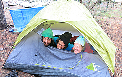
Three friends in a tent
At the Muir Trail Ranch, Marcus and Dylan had buddied up with Logan and Jacklyn Stellway and Michael Saldivar, who were traveling and sharing a tent together. The first night at Muir I had pleaded for quiet when, at 10 o'clock, they were happily whooping while playing a card game. The second night, after spending part of my planned non-hiking day getting to know them, I watched as they played their rambunctious card game.
There weren't any card games at Guitar Lake. Instead, late that afternoon the five friends backpacked three miles to Whitney Junction, where they camped, woke before dawn and used headlamps to cover the final two miles to Whitney's summit to experience the sunrise – and celebrate Marcus's 21st birthday. By the time Molly and I arrived at the junction – we'd intentionally slept in – they had returned from the summit and were readying for the hike to Whitney Portal.
Again the welcoming greeting, “Lee, Lee, LEE!”
I later learned they asked Molly a question they never asked me, “How old is your dad?”
Old. Very old.
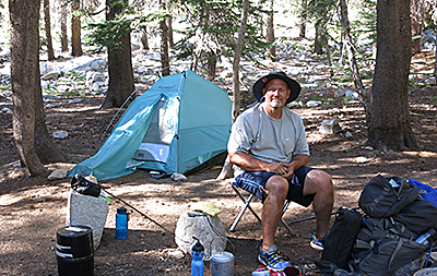
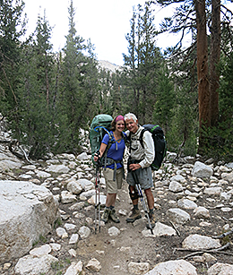
Bob at Deer Meadow
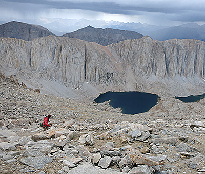
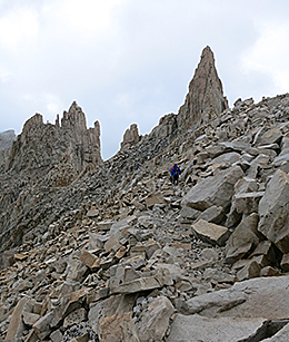
Hiking with Bob Carlson just happened. I'd been searching for a campsite near Deer Meadow. Bob, on a nine-day backpacking-fishing trip, offered to share. The next morning we separately climbed the Golden Staircase. The staircase gains 1,700 feet in three miles, reaching Lower and Upper Palisade lakes, a cirque surrounded on three sides by towering granite walls. Later, he and I played leapfrog, weaving up and over 12,100-foot Mather Pass before descending a series of small rivulets and grassy benches to a campsite at the South Fork Kings River.
Bob and I left separately the next day, following yet another corkscrew trail to deceptive 12,086-foot Pinchot Pass - deceptive because of its many false summits. But it was also scenically delightful because the trail curled above Lake Marjorie and other lakes glowingly illuminated by the shifting morning light. After Bob joined me, we headed to a hoped-for campsite at Sawmill Pass. Disappointed at what we found, we ate a late lunch and stumbled on. We finally settled at Woods Creek, reached by crossing a bouncy, one-person-at-a-time suspension bridge that one bubbling guidebook author calls the “Golden Gate of the Sierra.”
| |
 |
|
 |
|
| |
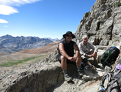
Bob and Lee at Pinchot Pass |
|
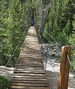
Crossing the 'Golden Gate' |
|
The next afternoon Bob and I said our goodbyes at Middle Rae Lake where he planned to fish and camp, while I continued on to Upper Rae Lake. But within half-an-hour both of us, disappointed at the camp prospects, met again. We planted ourselves at an obscure camp near a crossing that connects Middle and Upper Rae, where he fished and I swam. The setting was dramatic and engrossing - Upper Rae with its “floating” islands set against a backdrop of towering granite spires like those I'd seen in Patagonia. Adding to the fascination was a broad-faced mountain bisected by veins of brown, yellow, black, gray and butterscotch.
Meeting up with Molly
The final goodbye came a day later, near Bullfrog Lake. Bob was on his way out, planning to spend a night at Kearsarge Lake before exiting. We met Molly, who, as planned weeks earlier, was hiking in to join me for the final 51 miles to Whitney.
“See you,” Bob shouted. I hope so.
| |
 |
|
 |
|
| |
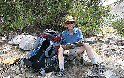
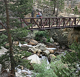
Steve Underwood, who joined Lee for three days |
|
Steve on a trail bridge |
|
As improbable as it seems, I was literally following in the footsteps of John Muir. On different days, Muir, or some darn good look-alikes, seemingly materialized. Once, after asking the best way to ford fast-flowing Evolution Creek, "John Muir" brusquely offered advice. Another day I met "him" while struggling up a steep climb. On his way down, he gruffly asked how I was doing.
“Working,” I answered. “Good,” he replied with happy growl. “That's what you're supposed to be doing.”
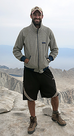
It had taken 23 days. I'd backpacked 211 miles up and down mountain passes ranging in elevation from 11,000 to 13,000-plus feet, a cumulative elevation gain estimated at about 48,000 feet. Finally, I was standing on the summit of Mount Whitney, at 14,494 feet the tallest point in the lower 48 states. Whitney was a mountain I had never climbed, so reaching its summit was a high point, literally and physically.
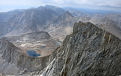
A view from Whitney's summit
So, resting atop Whitney, gawking at the scenery and savoring my accomplishment, what deep philosophical musings were swirling through my being?
Milkshakes. Chocolate, or maybe blackberry, or strawberry. Maybe one of each.
But it was still another 10 hiking miles to the Whitney Portal trailhead and its restaurant. That morning Molly and I gained 3,000 feet in elevation and hiked nearly six miles from our overnight camp at Guitar Lake to Whitney's summit. To shorten the day we considered spending a final night camping on the 6,000 vertical feet descent.
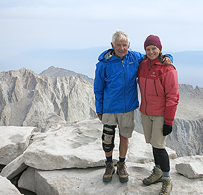
Lee and Molly on Whitney's summit
From Whitney's summit, basically an indiscernible high point along a broad, gently sloped granite dome, I looked back to the lakes and tarns we'd passed earlier that morning and down the more rugged, cathedral-like cirque we'd soon be descending. The view was gee-whiz impressive, with spire-like barriers of granite peaks. Most of the areas Molly and I had hiked the previous days – Vidette Meadows, Bubbs Creek, Wallace Creek, Crabtree Meadow, Tyndall Frog Ponds and Bighorn Plateau – were hidden behind the 13,118-foot Forester Pass. Molly had hiked in from Onion Valley via Kearsarge and met me at Bullfrog Lake. The 51-mile section we traveled between Kearsarge Pass and Whitney is known for its spectacular alpine scenery, and it didn't disappoint.
Nearly atop Forester Pass
Molly had led the way up Forester Pass, often regarded as the single-most beautiful section of the JMT. The trail from the north is nicely contoured, with eye-popping views of distant valleys and peaks, and up-close floral displays of elephant's head, buckwheat and sky pilots, purple-headed tubular flowers.
Molly almost invisible descending Forester Pass
We didn't stay long at our Forester perch. Light rain, which had cooled our ascent, increased as we wriggled down its south side, a wrap-around twisty trail with numerous exposed mountain hugging switchbacks. There's a trail-side plaque dedicated to a trail worker who died while helping to gouge and chisel the trail in the steep, resisting granite slopes.
Sierra Nevada thunderstorms, the guidebooks say, begin in mid-afternoon and last about a half-hour - most, but not all. On my day-off at the Muir Trail Ranch, it poured down non-stop, pounding rain. After finishing one paperback book, I picked up another, then finished that as well. Our first night together, Molly and I scurried to our tents when heavy rains accompanied an angry thunderstorm. The next night, it rained even harder.
| |
 |
|
The weather improved while we hiked through verdant meadows along Wallace Creek and the expansive Bighorn Plateau. When we reached Guitar Lake, hikers who had been a day or two ahead of us, including many of my new trail friends, had postponed climbing Whitney to wait out the storms. |
|
| |
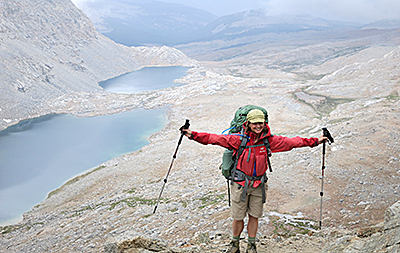
Relaxing at Guitar Lake |
|
|
|
| |
It was cloudy and cool when Molly and I left Guitar Lake shortly after dawn the next morning. We followed a series of switchbacks up to the Whitney Trail Junction where we left our backpacks for the final push. |
|
 |
|
| |
|
|
Leaving Guitar Lake behind |
|
| |
 |
|
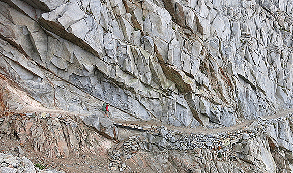
The final stretch is well-earned. We clomped up, over and around talus outcroppings and, more impressively, along rock towers and windows. Openings in the granite slabs provided electrifying views of the Mount Whitney Trail, guardian-like pinnacles and, far below, the Owens Valley. Eventually the trail opened up, climbing gently over granite slabs, gradually becoming almost highway-like smooth to the summit. |
|
| |
The push to the summit |
|
|
|
Ironically, Whitney is named for Josiah Whitney, a surveyor who wrote an 1864 Yosemite travel guide. Ironic because Whitney scathingly debunked Muir's theories on the evolutionary history of Yosemite Valley, calling him “an uneducated sheepherder.” This is even more ironic because Muir's theories on glaciation are regarded as correct.
Molly signing the Whitney register
We signed the register, peeked inside the summit, took photos, lolly-gagged and finally retraced our steps to the junction. The rain, which had obligingly held off, resumed and never really relented - not during the 97 switchbacks to Trail Camp, not down to Outback Camp. Temperatures, which had been toasty and humid, dropped almost as steeply as the trail. My raincoat helped, but my pants and boots were soaked. Another night of damp camping was not as appetizing as were an imagined hot meal and milkshake.
But when we reached Whitney Portal, a frosty cold milkshake wasn't quite so tempting. We ordered hamburgers and fries, but no milkshakes. Because the outside tables and chairs were soaked, we ate in Molly's car, which had been shuttled there a few days earlier. That evening in Lone Pine, a heaping salad loaded with fresh greens was the perfect meal. The milkshake? We planned to stop for one along the way home, but when we looked for likely diners, we found none. It was actually several weeks until I had that long-anticipated milkshake. Instead, for days after I arrived home, I scooped ice cream non-stop from the carton.Tasty, but not as delicious as the memories.
Editor's note This two-part John Muir Trail series is based on a series done for the Klamath Falls Herald and News. In July 2015 the Oregon Newspapers Publishers Association awarded Juillerat a first place in the 2015 Better Newspaper Association competition in the Best Lifestyle Coverage category.
 |
|
|
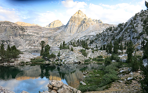
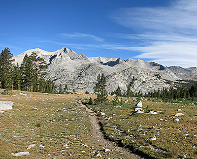
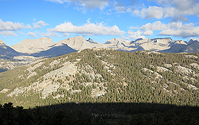
The Muir Trail is called America's most beautiful trail |
|
Sights from the John Muir Trail |
If You Go
Several coffee-table books provided some of the initial inspiration, including "Above All," with photos by David Stark Wilson and text by Steve Roper; "Walking the Sky," photos by John Dittli and essays by Mark A. Schlenz; and "The High Sierra of California," with woodcuts by Tom Killion and journals by Gary Snyder. The go-to/must-have pocket-sized trail guide to carry is Eric the Black's "John Muir Trail Pocket Atlas" at www.blackwoodspress.com. Trail planning was aided by the "John Muir Trail" by Elizabeth Wenk and "Day & Section Hikes" by Kathleen Dodge. Advance trail permits are required from the Yosemite National Park Wilderness Permit Office, www.nps.gov/archive/yose/wilderness/permits.htm.
About the Author
| |
 |
|
Lee Juillerat is a semi-retired reporter-photographer in Southern Oregon and frequent contributor to regional magazines and publications. Recent stories have appeared in Southern Oregon magazine, Alaska Airlines' in-flight magazine, Northwest Travel and others. He has written and co-authored books and brochures about a variety of topics and published photo-stories in High On Adventure for nearly 20 years. He can be contacted at 337lee337@charter.net |
|
| |
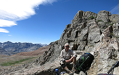
Savoring the view from Pinchot Pass |
|
|
|
|
|